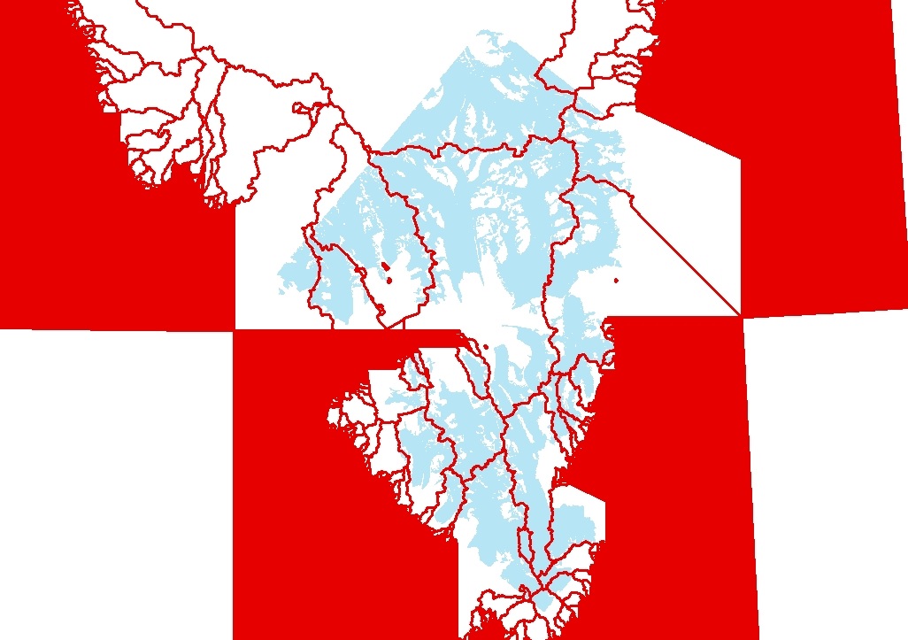
Drainage network delineation from ASTER
The aim of this post is to separate the individual drainage basins from the mask containing all the glaciated regions on the ASTER image obtained in the previous post. It is not possible to do this in a total automatic procedure. However we will try to do it as much as possible. A Digital Elevation Model (DEM) of the area covered by the ASTER image is needed.
Filling out the holes
Holes often appear in DEMs due to errors during the interpolation. For a 30-meter resolution DEMs, we can expect that between 1-5% of the cells to be sinks. This means that for a 1000 x 1000 grid (10^6 cells), there may be 10000 to 50000 sinks to be filled. Other DEM data sources may have higher or lower percentages of sinks, depending on how the surfaces were processed. This holes, therefore, are not natural sinks but mistakes that should be removed to ensure proper delineation of basins and streams. This is done in ArcGIS using the fill function which iterates different algorithms until all holes are filled.
Basin delineation
The Basin tool delineates drainage basins by identifying ridge lines between basins. Basin analyzes the direction of steepest slope to find all cells that belong to the same drainage basin. Then, drainage basins are created by locating the pour points at the edges of the Analysis window (where water would pour out of the raster), as well as sinks, then identifying the contributing area above each pour point. This results in a raster of drainage basins.
The last step consist just in a Raster to Polygon conversion of the final output (basins). And a final union of the big polygon of glaciated area and basins. This union will be carried out through Split or Intersect functions. The outputs from this will give a first approximation to glaciers delineation, however, for singular glacier delineation, manual rupture will be necessary.