Assessing GIA models over Antarctica
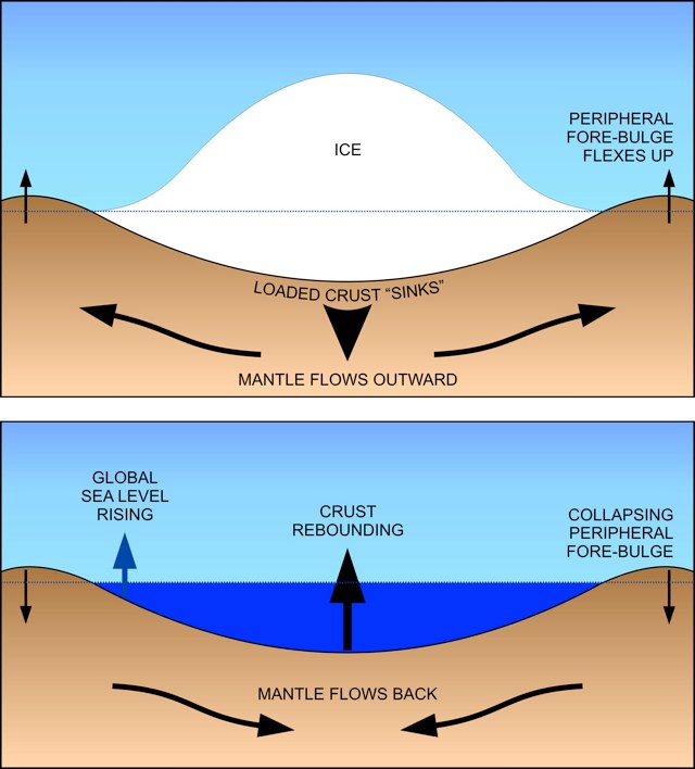
This post is about my latest research published in the Journal of Geophysical Research about the GIA response over Antarctica. But let’s start from the beginning… What is GIA? For those who may not be familiar with the term (I wont blame you!), GIA stands for Glacial-Isostatic Adjustment. This is a response of the Earth’s mantle to changes in the surface. The Earth’s mantle is a viscoelastic material which responds very slowly to changes in the surface. For instance, after the last glaciation (~20.000 years ago), the large ice-sheets lying over northern Europe and north America melted away, causing a “rebound” (or an uplift trend) of the solid Earth, which, in fact, is still going on!. We can still feel these changes nowadays, but GIA is a really difficult process to be measured, specially in Antarctica!
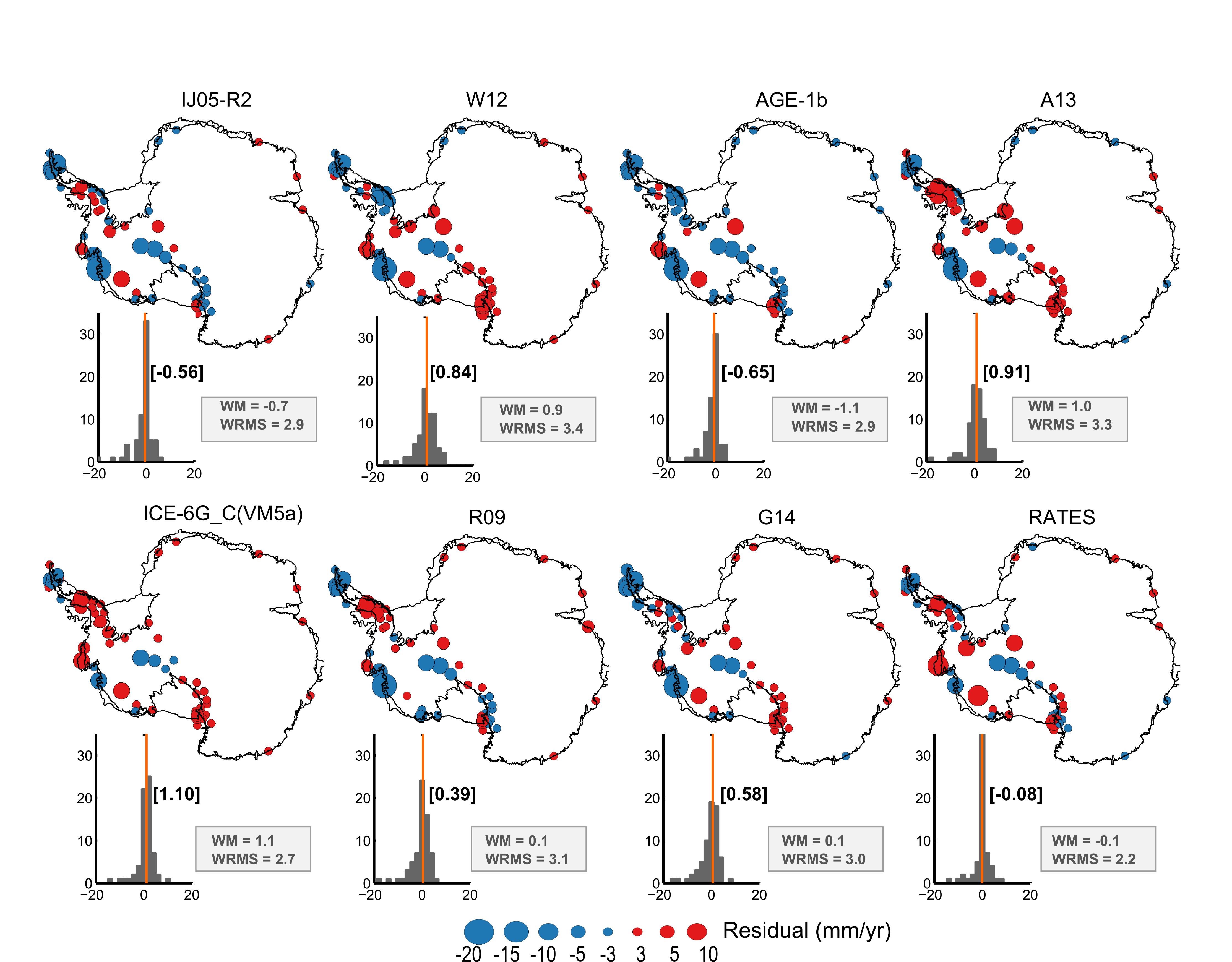
There are a few attempts to either model or solve for GIA processes in Antarctica. In this project I assess these solutions by comparing the modelled uplift rates with a network of GPS data gathered in Antarctica. We also bring along a new solution for GIA as a result of our RATES project
And here it is how do GIA models in Antarctica actually perform! This is an assessment made by comparing the modelled uplift rates with those obtained from GPS data.
Not really going into details about what the statistics WM (bias) and WRMS (standard error) mean and how they are calculated, but if you are interested I encourage you to read my paper.
Look at the results of our RATES GIA solution, we do very well!